| Hungary Table of Contents
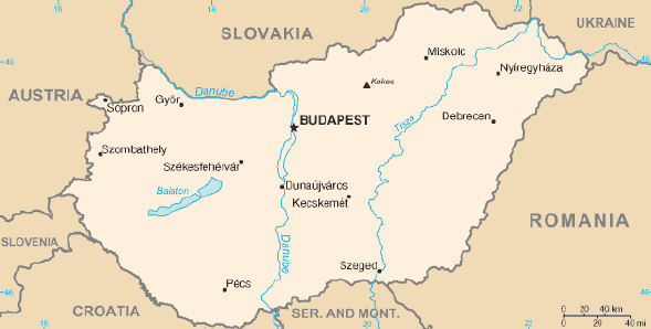
THE PEOPLE'S REPUBLIC OF HUNGARY lies in the central Danube Basin. With 92,103 square kilometers of territory, it is the sixteenth largest European country. The country's terrain consists largely of plains and hill country and is divided into three major geographic areas: the Great Plain, covering the central part of the country, the Transdanube in the west, and the Northern Hills along the northern border. The climate is mild and continental, although great contrasts in temperatures can occur.
Hungary is roughly the size of the state of Indiana. It measures about 250 kilometers from north to south and 524 kilometers from east to west. It has some 2,258 kilometers of boundaries, shared with Austria and Slovenia to the west, Croatia and Serbia and Montenegro to the south, Romania to the southeast, Ukraine to the northeast, and Slovakia to the north. Hungary's modern borders were first established after World War I when, by the terms of the Treaty of Trianon in 1920, it lost more than two-thirds of what had formerly been the Kingdom of Hungary and 58.5 percent of its population. With the aid of Nazi Germany, the country secured some boundary revisions at the expense of parts of Slovakia in 1938 and Carpatho-Ukraine in 1939 and at the expense of Romania in 1940. However, Hungary lost these territories again with its defeat in World War II. After World War II, the Trianon boundaries were restored with a small revision that benefited Czechoslovakia. 
Custom Search
Source: U.S. Library of Congress |